Closing entry...and apologies for the long gap for anyone following this blog! Unfortunately did not get much further than Bellinzona in the greater scheme of things....foot too painful. After indeciveness and backwards and forwards-ing (not wanting to admit what I had realised...probably same reason as delay in putting this entry on) therefore ultimately stopped walking. Have therefore looked around for alternatives that involved less bending of the toes and done a long cycle trip from the north coast of scotland down and around england (foot seemed fine for this in wlaking boots). Have therefore done my remaining 1,500 miles or so, although not quite as originally intended!
So...I can't complain as was a great trip as far as it went and also a good cycle trip. Is a shame though as was going very well until then and obviously lots of effort going into to it as well, also was starting to approach the higher alps just as the snow was melting off and allowing higher passes to be crossed. On the other hand was good to get to the level of fitness and enjoyment needed to do the trip (and to have been on track to do it) even if only for part of the intended route. Won't be an immediate return, but we shall see at some point - trips like this are probably both a good way and a good incentive for a long term high level of fitness...its added to the future projects list!
Anyway, if anyone needs recommendations for long distance hikes in the eastern alps in the early season then let me know!
Bye for now,
Graham
Wednesday, 13 October 2010
Sunday, 25 July 2010
Back to the Alps
Slightly longer break than hoped for, but am back out to the Alps tomorrow to continue. Foot still not perefect, but improved, and besides we have eaten all the strawberies. A visit to a podiatrist suggested that the probelem was with the second metatarsal (either a hairline fracture or other inflammation) due to likely putting too much weight on it due to defective big toe joint. Best way to avoid problems with it seems to reduce the amount of bending, and in the circumstances his recommendation to do this was just to wear stiff boots. Discussed what I am planning but it seems that if I can carry on without it hurting then shouldn't be making it worse. So, am headed back out tomorrow, with plan to walk in heavy walking boots. Much less suitable for wlaking long distances on paths, but we will see!
Thursday, 8 July 2010
Visit home
Unfortunately foot not improved so rather than make it worse am back home to Aberdeen for a visit to a podiatrist - hopefully back on trail soon! Anyway, a good time to visit...went out and picked almost 10 lb of strawberries from our back garden today.
Saturday, 3 July 2010
Tirano to Bellinzona
Am in Venice for a long weekend with Gill, having headed out from Bellinzona on the train yesterday...was quite satidfying to head across italy on the intercity at speed for several hours...seemed a long way back across the country!
Varied section again. Despite the weather forecast of grim weather returning, this did not happen (hooray!) and weather was uniformly good, a very welcome change compared to the previous week! Still evidence of the bad weather however in the form of a significant amount of fresh snow around the Bernina area, down to not much over 2000m in places. Therefore again, more devising my own route...after starting on the Via Alpina from Tirano, headed further north to go over trails south of the Bernina pass, and then followed along above the north side of the valley system, opposite the Piz Bernina and Piz Badille. This was now in Switzerland, which you could tell by the comprehensive signposts, it took half an hour sometimes just to read all the destinations, couldnt possibly get lost...awesome! Fortunately (hurray again!) the new snow was pretty much confined to the area around the Bernina itself, so was able to still follow a good route...very good views from the balcony trail above St Moritz, and subsequently (after passing the Maloja pass) ver the Val da Cam (almost 2,500m, the highest point on the route so far in fact).
Unfortunately after this things slowed down a bit, due to a sore right foot. I think I have been too successful in accustomising the muscles in my feet to walking over uneven ground in light footwear, and the other parts were therefore a bit bruised after some big days. Various shorter and longer days followed...past Chiavenna and over the Passo della Forcola (very fine but very hot...7,000 feet of ascent with a starting temperature of 30degC in the valley...once more the umbrella invaluable for sun as well as rain. very fine bivvy spot also at Alpe de Quarnei). However, the foot was definitely objecting, so have had a copule of rest days in Bellinzona, linking into the long weekend planned with Gill in Venice. Foot definitely better than it was, but slightly concerned that it might end up requiring the simple, effective and easily available remedy I dont want to give it i.e. spend a while not walking long distances on it. Have my boots (thanks to Gill, with many other small but critical requests for assorted materials) for the next section so will see how it goes with a bit more prtoection.
Into July then...have worked out that have covered about 1400km (almost the same each month at 700km, June would have been bigger if not for slow down over last week), so assuming no long term problems with the foot am roughly on track. So far despite my constant route variatons I have roughly covered the same distance as the Via Alpina would to get to the same point. Might however be trying to take a slightly more direct route on the next parts to get to Monaco not too long after the start of August, in order to ensure plenty of time in France and Switzerland (as far as I remember from doing things like the Tour de Mont Blanc, its not quite so hot and not so many snakes, which continue to here and there consider the path a good place to go to sleep on).
Have confirmed with Nathalie at the Via Alpina that there is a bug in the height calculator in their data, so my observation that the ascent is overstated is correct. This is reassuring, both in terms of the route ahead and also in terms of the route so far, where I have done about 70% of the ascent I expected...nice to know that this is probably comparable and am not missing out (people might start thinking this is a holiday or something!). Also reassuring as I think the amount in my figures would in fact not be possible for me in the timescale, given the heat in particular.
Anyway, off for beer, concert tomorrow, sightseeing in Venice etc and then back to Bellinzona Tuesday, arriving mid afternoon for a hot walk along the valley.
Friday, 2 July 2010
Venice
No, Graham hasn't taken a wrong turn, I'm off to meet Graham in Venice today - if I recognise him under his beard. I'm sure there will be an update in the next few days. Over the last couple of weeks Graham has been crossing from Italy to Switzerland on a regular basis, and going past ski resorts like St Moritz and other places. He's catching a train over to venice. I think a few days of heavy ice cream consumption and a bit of sight seeing will make a nice change.
I'm sure there will be many new photo's next week
I'm sure there will be many new photo's next week
Monday, 21 June 2010
Bolzano to Tirano
Am in Milan for a rest and resupply day - mainly wahing and drying things! Last week has ben not ideal weather, in fact has rained most of the time. I needed to make up a route anyway to cut across from the vicinity of the yellow via alpina trail by Bolzano to the vicinity of the red trail by Tirano, so not a bad week to be putting together a not-quite-so-high-up route. The challenge is then to identify something that is suitable for the conditions but isnt just walking along the main road. (as commented previously, if I want to do the whole trip in the available time, then probably need to progress in some way most of the time, regardless of weather). This isnt helped by the Kompass Italian maps seeming rather less consistent on the trail marking than the Kompass Austrain ones - minor road / track in particlar seems to signify a wide variety of things, in one case being non-existent and in one case pretty much a high street, with everything in between. All in all have managed to put a good route togteher, with only a few very short sections of scurrying along the main road to reach the next track! There were some very satisfying bits also, managing to hit the high points at the breaks in the cloud - M Roen next to Bolzano, crossing the Passo della Forcola at the northern end of the Brenta dolomites, and also the high roads traversing the hills SE of Tirano (tarmaced and so a bit hard on the feet, but certainly no traffic and at just that right intermediate altitude to get superb views of everything).
Arriving in Tirano and in need of a night indoors to dry out, the whole town was full (tried 7 places) and no campsite. Therefore spent a wet bivvy and got the 6am train to Milan where I spent yesterday / last night snoozing and washing clothes. Off shortly for the usual map shopping, post last set of maps home, buy food, etc as always before back to Tirano. Might also look for some boots, have been doing the trip so far in lightweight walking trainers, very light and confortable and grippy but definitely limited ability to keep your feet dry in consistent wet conditions. Will also be doing more high level walking from here on (assuming the weather improves! forecast currently looking ok...) so more snow likely crossing likely.
Plan from here is to follow the red via alpina trail (weather and snow permitting) to Biasca, from there will have to see what date I arrive and work out a route on that allows me to get to a train station somewhere for meeting up with Gill for a long weekend start of July.
Languages also changing as I go of course. Was just srating to remember enough German when I crossed in Slovenia. No Slovenian but as I was only crossing the corner of the country for a few days have got by. Must get hold of an Italian phrasebook and pick up some Ialian - so far however, have been in aprts of
There is now a link to this blog also on the via alpina website...
http://www.via-alpina.org/en/page/754/and-those-who-are-setting-off
Monday, 14 June 2010
Rest day in bolzano
Day later in Bolzano, everything washed and fixed and ready to go again, and in possession of maps, food etc for the next stage. Its quite tricky slecting the maps for a make it up yourself stage, as I'm not totally sure which way i want to go until i have the studied the large scale map plus all the ones that follow i in a prticalr direction. Have therefore been standing in shops with my european road map, folding and unfolding various maps and working out which follows which! Anyway all set, without having bought too many excess maps (although still probably the main source of unnecessary weight in my bag), next aiming point Tirano.
Sunday, 13 June 2010
Bolzano - overview so far
Am in bolzano and have internet access again. And, at an estimate, have now walked about 1000km, hurray!
Have not done much apart from walk, eat and sleep - therefore tired, but healthy and not particualr problems so far. Since my last post I have crossed into Slovenia and then Italy, across the Dolomites. Days have been getting longer, close to the kind of distances and ascents that I need to be doing to get all the way round (20 miles or so with anything up to 9,000 feet of ascent). Am starting to find the heat quite a challenge however - since about Lavamund in southern Austria it has been getting hotter and hotter, and in particular very often is totally still and humid - ability to walk uphill is very often limited by overheatibng rather than fitness. Very often getting through 4 or 5 ltr of fluid just during the daytime, and feeling the need to find more places to stay to find a shower (campsites good: have showers but can still get away early to beat the heat a bit). Also, there has been more 'mountainous' walking than previously. Most of the sections in Austria were relatively straightforward (apart from the snakes) and the difficulty could be pretty much expressed as x miles and y feet of ascent. Since then the route has been generally higher and rougher going: more rough ground and / or exposed paths, requiring more time and effort than previously. I therefore feel on balance rather less fit than a few week ago, but this is probably not the case!
Snakes - 7 so far, only one of them (a large, sleepy adder that gave me a bored kind of look and then curled up again) refusing to move from the path when I asked it too. Fortunately not too steep to go around!
The character of the trip has also been a bit different the last week or two. Previous to that my route pretty much followed the Via Alpina exactly, since Slovenia I have used it more as a general line but have made up my own route. Various reasons for this. As a general one, the Via Alpina was marked on all the Austrian maps but not always since, and with the instructions from the internet not always being definitve the route has felt generally less definitive. Then more specifically. In Bovec (Slovenia) I couldn't find any maps for cross border into Italy, so ended up follwoing a minor road (marked on my map of Europe!) to get to Resiutta in Italy. Next, buying maps which didn't quite cover the right sections, so choosing a very close but parallel route instead. Finally, choosing a few alternative paths in expectation of too much snow on a few of the higher passes.
Last one is significant. I have been looking ahead at the route and anticipating any sections that, in the event of my not being able to get through (snow, bad weather etc), would give significant extra milage to either retrace my steps and / or find an alternative route. Am starting to realise that this is quite a long trip (if that's not a foolish comment) - although I am certainly not taking a beeline route (several detours have been slightly longer than necessary in fact), I am definitely looking ahead and ensuring that I go ways where there are alternatives, so that I will pretty much always be progressing in some way shape or form. The trip would just feel too big otherwise. Similarly there will be days when the weather will be too bad to go too high (although so far have generally managed to fit rest days around these), likewise will probably have to push forward on lower routes on these days given the time constraints.
On balance I have ended up doing a bit more distance but a bit less ascent than expected. The VA descriptions seem to be accurate on distance but several times have overstated the ascent.
Whether I will go back to following the VA more exactly we will see - the next section in any case is planned as a make it up as I go, to join the VA red trail in the vicinity of Tirano.
Wednesday, 9 June 2010
Slovenia
Well Graham managed to get through the Slovenian Alps in about a week.
It's been a fairly mixed week, the weather has been a bit mixed.
There was still about 2m of snow on some of the higher passes which he was planing to take so there was a few changes in route.
Also he came down with a bit of a bug so had a rest day where he pretty much slept most of the day.
The light weight boots have also proved an issue, they were light weight, but maybe not quite up to the mileage / weather which this trip has given them. Still averaging about 20 - 25 miles a day - with the rest/ill day the only exception where he did 8 miles before breakfast (and then slept).
Also maps were not quite as easy to come by as Graham had hoped, a couple of days he's been using a 1:500000 map of Europe to navigate by. I can imagine how depressing it is to look at the map and see over the course of the day you've only moved a inch or 2 at the most. this section was on minor roads, but the views and scenery were still pretty spectacular.
Graham then crossed into Italy on 3rd or 4th June - 2 countries in only a month!! Pretty impressive stuff
Thursday, 27 May 2010
Bruck to the Slovenian border
Graham is fairly getting on now, he is hoping to cross the border from Austria into Slovenia on Friday 28th.
So far communication has been pretty easy, he's phoned most days. Fingers crossed the mobile signal and solar charger combo will continue!!
The weather has remained hot, with Graham drinking 5L of water one day. Due to constraints with bivying he's been staying in huttes or B&B most nights, but is now thinking that he might have to start sleeping out, if for no other reason than to get an early start in the morning, have a long siesta at lunch time and walk into the cool of the evening.
He has come across quite a few snakes in the last few days, mainly adders. the 1st couple were dead but the last few days they've been alive - and happily hissing as they slither quickly away.
He has fairly been clocking up the miles now too, last Friday he walked 32 miles...... although 5 was trying and failing to find the hutte that he was hoping to sleep in that night. After that he had a well deserved rest day - but unfortunatly no internet was near at hand.
Today he did 9000ft of assent (more than 2 x Ben Nevis!!) He is pleased with his progress as he is now managing the miles and the assent which should keep him on track to complete the walk.
He is also quite pleased with how his German has come on - perfect timing to forget it all before needing in again in several months time when he heads into Switzerland.
Heading into Slovenia there could be some extra miles as the map is a larger scale than the ones he's been using in Austria.
Sunday, 23 May 2010
Some photo's from Bad Goisein to Eisenerz

The 1st sign post for the Via Alpina - A good sign amongst the many!!

A fine 'see' for a picnic

Who's that hiding there???? A common feature on the walk

The view from Weissenbach - and towards the next days walk!

Yet another picnic - one of my fav things about walking!!
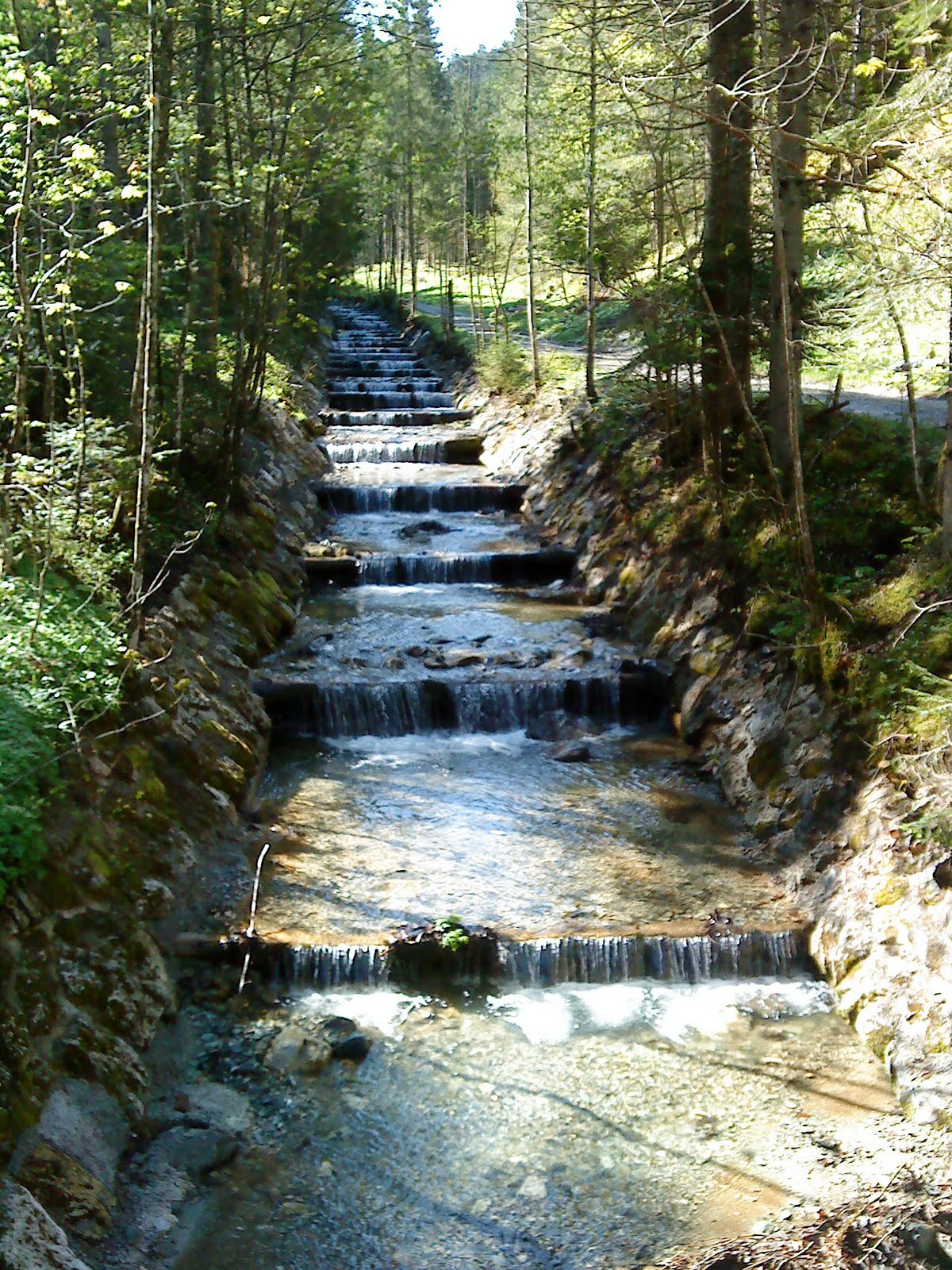
A fairly well structured stream.


A view of the eastern alps near Leoben

A lunch time stop at one of the mountain huttes, unfortunatly it was closed but we were all stocked up and able to make our own tea. Typical, just as we were heading off the guy came and opened up the hutte.............


A lunch time stop at one of the mountain huttes, unfortunatly it was closed but we were all stocked up and able to make our own tea. Typical, just as we were heading off the guy came and opened up the hutte.............

Looking back down to Radmer
Tuesday, 18 May 2010
Eisernerz to Bruck
Five days further on and am at Bruck...not far from Leoben where Gill got her train 5 days ago, but properly here (having walked), rather than just on a day off to see Gill off. Unfortunately since then the weather has not been the best...has changed from just bad higher up to extremely bad at all levels!
I headed east from Eisenerz across the south side of the Hochschwab range, initially with some good views of the impressive limestone cliffs immediately above, but these soon disappearing unfortunately, leaidng to slow picking out the path in the mist where snow patches covered the markers. As the weather got worse my route followed lower routes, until I reached Seewiesen at the east end of the Hochschwab. My original idea had been to climb up from here to the east end of the plateau, and, ideally, gaze eastwards at dawn from a high bivvouac. However, by now the forecasted 130 km per hr wind with fresh snow down to 1200m was fully in evidence, so instead just took a rather misty photo from the baclony of the Seewiesen Gasthof and set off directly on my southward leg the following morning. Camping in the valley the following night tested out my tarp (10' square nylon sheet which is pitched using a walking pole at each end, not unlike a tent flysheet with open ends) in high winds, having to repitch it lower during the night. Back rather sore the following day proabably from grabbing at tarp edges as they blew away and crawling around under it very low pitched (for wind resistance). Therefore a rest day and resupply in Bruck, plus hot showers and ibuprofen, should avoid any problems.
Have covered 70 miles in about 4 days which is encouragingly close to the distances I will need to be covering, although not as much ascent or rough going yet as I will need to be capable of. Very encouragingly the fresh snow doesn't seem to have reached these hills, presumably being shielded by the higher mountians to the north and west. If feasible, I'm planning to follow the high (up to around 2000m) ridge of the Gleinalpe which runs directly southwest from here to rejoin the Via Alpina between Knittelfeld and Gaberl. From there on plan is to follwo the Via Alpina more closely, depending on weather conditions and degree of waymarking, we shall see...
Bad Gosiern to Eisenerz
First 2 weeks complete and Gill has headed home for the UK leaving me to continue by myself (second entry to follow if connection is fast enough to exceed my supply of euro pieces). Sucessful start to the trip...have covered 100 + miles, not yet as many per day as I will need to, but of course this was the start of the building up of fitness. The route taken was a bit varied, down to early spring conditions and various other reasons as follows. We started on the Via Alpina, but soon diverged southwards where scrambly sections were covered in snow and bad weather. Our route followed the south side of the Totes Gebirge range to rejoin the Via Alpina near Spital am Pyhrn...but soon departed from it again for my planned detour to the Hochshwab, heading east along the southern edge of the Gesäuse national park to reach Eisenerz.
Various excitements were had. As well as extra miles spent retreating from snow covered passes, landslides were an occasional early season feature. The first time we discovered this was following the Geo Trail along the south shore of the Grundlsee...it seemed a bit unusual in Austria that there were no signposts for it, and sure enough this was becasue they had been taken down - you could get most of the way along before reaching the impassable, half collapsed bridge, so back again and round the other side instead. The second occasion we fortunately met a friendly local who advised in advance to take the forest road instead of the path, so avodied any problems. Instead came across forest work closures (big dangerous machines) and hunting (or deer breeding) restrictions(large fences) which again added some miles to the trip.
On the whole though very pleasant and we got to where we were trying to get to. The weather was not often good enough to see the high mountains, but was not too wet lower down. Pleasant walking along a mix of paths and forest tracks with an occasional glimpse of limestone cliffs above on some days.
We had pushed on without any rest days, being a bit nervous of the weather and with Gill not wanting to miss her flight and be potentially enlisted for the full trip. We therefore ended up with 2 spare days at the end. In Eisenery (the Llanberis of the Alps) the quarry was having a celebration of their 250 million th ton of iron...included free large explosion (one only), food (although a bit of a fight at the counter) and beer (as much as you managed to scrounge free tokens). The following day we decamped to Leoben (time out for me) to make doubly sure Gill could get her train and for a day at the pool - sauna. The following day Gill departed and I retruned to Eisenerz, and pouring rain.
Sunday, 16 May 2010
To the start of the walk
 What a great couple of weeks to start the walk! The plan has changed slightly from the original idea, as Graham was so close to the east side of the Alps he thought he would head to the most eastern Alps and take in a summit, this is only an extra 4 days or so (and a few extra miles of distance and accent) on top of the Via Alpina.
The weather was pretty good to us most of the time, the sun was often out and we only got rained on a couple of times. By the time i left I think Graham had only worn his waterproof jacket once and the trousers had never even been out the bag. The 'chrome dome' or umbrella as it might be more commonly known, has been a good investment so far, both for sheltering from the rain and more often from the sun.
We flew out to Munich on 1st May, then got the train to Salzberg, where we stayed overnight before getting the train on to Bad Goisein on the sunday morning. We headed to the centre of town, the official starting point of the walk. Graham started walking about 11.45 on 2nd May.

Friday, 23 April 2010
The plan
I am setting off on May 1st to try to complete a continous, high level circuit of the Alps on foot, finishing by the end of October (or earlier - snow conditions permitting!). The starting point will be Bad Goisern in Austria: chosen in order to start and finish in the east where the route is generally lower, and therefore (potentially) less snow at the start and end of the season. From there the route will go southeast into Slovenia, west along the southern side of the Alps through Italy and France to Monaco, then back east along the northern side of the range through France, Switzerland, Germany, and back to the starting point in Austria.
Clearly if one took a strict definition of walking round the whole of the Alps, then one would most likely be walking along a motorway at sea level: not the intention! Therefore, to give the freedom to choose an inspiring route while remaining true to the concept, the route is defined as follows. It will pass strictly around each end of Alps; in the east the Hochschwab, being, slightly arbitrarily, the last major area of ground abve 2000m; in the west, Monaco, being, rather more definitively, where you run out of land. In between however, the route will be defined as I go according to the most aestetically pleasing, high level route, taking in as many of the key ranges as possible.
Having said that, I am anticipating that large parts of the route will coincide with the Via Alpina path network, so to get a good idea of what it could look like, see...
http://www.via-alpina.org/
...and visualise the largest loop that the trails shown here suggest.
Based on published information on the Via Alpina, the route could involve around 2,500 miles and 1,000,000 feet of ascent.
I'm planning to update this blog as much as possible as I go, in practice it is likely to be fairly intermittent depending on internet access along the way. In the meantime I will try to capture some of the aspects of a trip like this in the pages section, and then from next Friday, watch this space...
Subscribe to:
Posts (Atom)